Skip to content

Thrace

Thrace

Holidays in Thrace

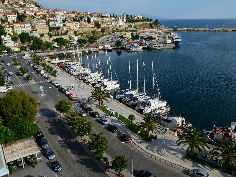
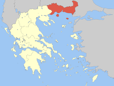
Thrace Eastern Macedonia and Thrace (full name) is the northeastern part of Greece ending at Alexandroupolis on the south and Orestiada almost to the north. This is the part connecting Europe with Asia and the Aegean Sea with the Black Sea. Life shows its existence since 3000 BC here. The name of this part according to the legend comes from “Thrace” the daughter of Oceanus, sister of Europe, Asia, and Libya, or from the Greek word “trahia” which means a rough area because of the climate and the environment.

This is the place where since the ancient years as it is said many religious ideas and ceremonies (Orfika, Dionisia, and Kaviria) came from.

The area of Thrace consists of three prefectures, Evros on the east, Rodopi in the center and Xanthi on the west. Excavations at the area have brought up samples of life starting from the Palaeolithic Age near the rivers Evros and Ardas. Close to the end of the Bronze Age and the beginning of the Iron Age Thracian races start spreading in Trace continuing the prehistoric tradition. Settlements of that age have been found both on naturally protected hills known as “Thracian Citadels” and flat locations.

When Thrace was part of the Roman Empire the Romans promoted and strengthened the local Greek character. Via Egnatia was constructed remains of which can be found in numerous places along the main route to Constantinople. During the Byzantine Era, the area is close to the capital city Constantinople and once more many monuments bear witness to its prosperity: Didimotiho, with its castle and 23 towers, the fortress of Ioannis Katakouzinos in Pythio and the cavern of Agios Theodoros in Alexandroupolis transformed into a temple wall painted in two phases. Since the 18th century, the Greek element of the area has flourished both economically and intellectually. Traces of this peak can be found in Soufli, the land of silk, Metaxades, and Didimotiho.

Today Thrace has to offer a lot to a visitor. The town of Xanthi the first to visit leaving the prefecture of Kavala, where the University of Thrace is based, the town of Komotini capital of Rodopi prefecture, built around a pre Byzantine fortress of the 4th century BC and Alexandroupolis the capital of Evros prefecture, from where one can easily visit the island of Samothraki and the Evros Delta, known for the ecosystem with international importance according to the Ramsar Convention. Delta’s geographical position and climate contributed to creating a vital place of hospitality for a great variety of animals. Lakes, lacy coasts, peninsulas and many branches of Evros River form a unique environment suitable for the survival of rare species of fauna and types of flora all over Europe.

Booking.com
Booking.com
Booking.com

Cultural tourism (archaeological museums of Drama, Philippi, Kavala, Port of Thassos, Abdaron, Komotini, archaeological sites of Philippi, Avdira, Maroneia, Doxipara, Samothrace, Agia Varvara Drama, Imaret Kavala).

Religious tourism (Monastery of Agios Apostolos Silas Monastery, Agia Lydia Monastery, Monasteries of Panagia Archangeliotissa, Panagia Kalamou, Taxiarchon and Agios Nikolaos Porto Lagos, Byzantine Mount Papikion, to the border of the Dadia Monastery and the Cosmos).

Conference and exhibition tourism (Lydia Conference Center, N. Karvalis Exhibition Center, Komotini Exhibition Center, Thracian Art & Tradition Foundation, and hotels in each city have the infrastructure for hosting events).

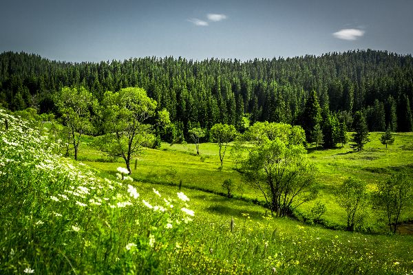
Ecotourism (Forests of Elati, Frakto, mountainous Rodopi, Delta of Nestos and Evros rivers, Pomakochoria, beautiful shores of the Thracian Sea, imposing mountains and forests, Maara caverns and rocks of Petrousa in Drama, Vistonida, Mitroikos, Ismarida, biotope of exceptional beauty and unique ecosystems with impressive landscapes).

Therapeutic – thermal tourism (Lasopotouras Krinidon, Thermal and Thermal Baths of Xanthi, Samothraki, Traianoupoli).

Agrotourism (in recent years remarkable agrotourist accommodation has been created in all prefectures).

EVROS

It has a border on the northwest with Bulgaria, with Turkey on the east, the county of Rothopi on the west and the Thracian sea lies to the south.

This county is the gateway to the East, both for Greece and the European Union as it is on the border with Turkey.
The river Evros winds its way peacefully through the county of the same name, on its way to the Aegean sea where the Evros Delta has been forged. The aquatic habitat and ecosystem here are indeed a rare sight and are amongst the most significant of their kind in the whole of Europe.

More than 200,000 waterfowl spend the winter on the huge expanses of the Delta. Many of the 300 or so species found here are threatened with extinction.

As well as the Delta, the Dadia forest is also a haven for wildlife and rare birds of prey safely nest there, under the protection of the authorities.

The beaches of the county, with their blue flags, from Mesemvria to Alexandroupolis, also deserve a mention and are very popular with holidaymakers.

Booking.com

ROTHOPI

This county lies on the Aegean sea to the south, borders Bulgaria on the north, the county of Evros on the east and Evros on the west.
This is a beautiful yet quiet area, which attracts few visitors in comparison with the rest of the north of Greece. As a result, visitors can enjoy the natural beauty of the area and visit its picturesque villages at a leisurely pace, unharried by the hustle and bustle that well-developed tourism has brought to other areas.
This county offers forests, small ravines and the lively streams that flow from within, endless green plains, spectacular beaches, and ancient sites.

This is the land of Orpheus and Dionysos and is most hospitable, offering every visitor a warm welcome.

XANTHI

The counties of Drama and Kavala border Xanthi on the west, Bulgaria on the north, Rothopi on the east and the Aegean sea lies to the south.
The history of this county is interesting, as is the presence of a large Muslim population that coexists peacefully with the Greek element of the population.
Nature lovers will appreciate the Rothopi mountain range and the deserted villages and stone paths that lie therein, as well as arched bridges, water pumps and whatever else the roots and earth of the thick forests haven’t covered up.

One can visit Pokamohoria, which are villages dotted all over the Ehinou valley. These villages are examples of a unique cultural and architectural style which can be found nowhere else in Greece.

The natural landscape in this county is a paradise with its rare species of flowers, birds and a wonderfully balanced ecosystem.

This county also offers spectacular beaches and important historical monuments.

How to get there

By Boat

Kavala is a major port. it is possible to reach it by ferry from Lemnos, and several other North Aegean islands.

By plane

 There are direct flights to many European countries, especially in summer and daily flights to Athens. Except with Taxis, the airport(“Alexander the Great” airport) is hard to reach by public transport. Car rental at the airport is available.

By regional coach

Interurban coaches “KTEL” buses are by far the most convenient way to travel around Greece, as well as for intra-regional travelling. Intercity buses drive to all major cities in Greece.

The timetable for busses to Ioannina is 9 am, 11 am, 1 pm, 3 pm and 5 pm.

Major communities

  • Alexandroúpoli
  • Dráma
  • Kavála
  • Komotiní
  • Xánthi
  • Samothrace
  • Thassos
Eastern Macedonia and Thrace

Distances

Thessaloniki – Kavala > 152 km

Thessaloniki – Xanthi > 205 km

Thessaloniki – Alexandroupolis > 301 km

Kavala – Athens > 651 km

Alexandroupolis – Bucharest > 528 km

Drama – Skopje > 365 km

Komotini – Sofia > 320 km

Alexandroupolis – Athens > 800 km

Kavala – Constantinopole > 443 km

Xanthi – Belgrade > 823 km

Xanthi

Monasteries

Monastery of Panagia Archageliotissa Monastery of Pamegiston Taxiarchon Monastery of Panagia in Kalamou Monastery of St. Irene and many small churches...
Read More

Avdira Village

Its mythical foundation was attributed to Heracles who founded the city on behalf of his fallen friend Abderus. The historical founding is traced back to a colony from Klazomenai...
Read More

Old City

The Old Town of Xanthi is known throughout Greece for its distinctive architecture, combining many Byzantine Greek churches with neoclassical mansions of Greek merchants...
Read More

Nestos river

It rises in the Rila Mountains and flows into the Aegean Sea near the island of Thassos. It plunges down towering canyons toward the Aegean Sea through mostly metamorphic formations...
Read More

Alexandroupolis

Lighthouse

Landmarks in Alexandroupoli include the city's lighthouse in the port, the archaeological sites of the Mesimvria Zone and Maroneia stretching out to the small port of Agios...
Read More

Avantas Castles

The entire area has castles on rocks that allow the supervision of the passage from Rhodope and Komotini. The Castle of Avantas is also called Boz Tepe, from the homonymous hill on which...
Read More

Organized Beaches

1. Charama 2. EOT Beach 3. Santa Rosa Beach 4. Delfini 5. Afroditi or Baobab

Evros Delta

The Evros Delta National Park is formed in the estuary of river Evros and is one of the most important wetlands in Europe. Waters and sentiments that come with the river, together...

Kavala

Castle of Kavala

During the Byzantine period, Kavala became part of the “East Roman Empire”. Remains of the Byzantine fortifications can still be seen at many points on the old town (called Panagia), as well as the imposing Castle...
Read More

Tobacco Museum

Museum of Kavala includes objects and archival material for the production and cultivation of tobacco, its commercial processing, industrial tobacco products and exhibition samples...
GPS coordinates

Ikosifinissa Monastery

The Monastery of Ikosifinissa is on the most important monastery of Macedonia that gathers people in order to pray in favor of Panagia Ikosifinissa and to embrace the Acheiropiitos icon of her...
GPS coordinates

Kavala Aqueduct

The Kavala aqueduct, popularly known as the Kamares is a well-preserved aqueduct in the city of Kavala, and is one of the city's landmarks...
Read More

Saint Paul church

It is dedicated to Apostle Paul who went to Kavala and preached Christianity. At the point where he first arrived nowadays stands a monument to commemorate his arrival in Europe.

Organized Beaches

Keramoti / Ammoglossa Kalamitsa Batis Perigiali Rapsani Ammolofoi Nea Peramos

Nea Perarmos

Nea Peramos, is a town located 17 kilometres from Kavala. Due to its situation the village Nea Peramos is a good starting point for excursions to the island of Thassos which...
Read More

Ancient Filippoi

Philippi was established by Thasian colonists in 360/359 BC with the name Crenides. In 356 BC Philip II of Macedon, conquered the city and renamed it to Philippi.
Read More

Drama

Oneiroupoli

Oneiroupoli is a place where concerts and happenings take place. Everything starts at the beginning of December and last a month...
GPS coordinates

Park of St Barbara

A beautiful park in the city of Drama! It is located right across the church of Saint Barbara. It is one of the 50 best parks of Europe...
GPS coordinates

Aggitis Cave

World's largest river cave. he Angitis cave is 21 km. long. A short distance from the cave is the gorge of the river ...
GPS coordinates

Archaeological Museum

The exhibits record the cultural history of Drama prefecture from the Middle Palaeolithic. The oldest finds come from ...
Read More

Komotini

Imaret of Komotini

Imaret of Komotini one of the oldest Ottoman monuments in Thrace from 1360-1370. it was built by the Ottoman Gazi Achmet Evrenos...
GPS coordinates

Tower Clock

Sultan Abdulhamid II erected a clock tower and a madrasah. During his reign, the town became a station in the railway linking Constantinople...
GPS coordinates

Folklore Museum

It is a project to classify and display its considerable collection of costumes and artifacts of the folk culture of Drama and the it has devoted a large part of its...
GPS coordinates

Monasteries

Agia Irini Holy Virgin Kalamou Saint Nicolas Monastery Virgin Mary Pantanassa Panagia Archaggieliotissa

Samothrace

Palaiopolis

Paleopolis was the ancient capital of Samothrace and is dominated by Mount Fegari. It was from here that Poseidon observed the siege of Troy. Philip of Macedonia...
GPS coordinates

Chora of Samothraki

Chora(capital) is located 5 kilometres from the port Kamariotissa, in the inside of the island. It is built amphitheatrically on the foothills of mount Saos...
Read More

Nike of Samothrace

The Winged Victory of Samothrace, also called the Nike of Samothrace, is a marble Hellenistic sculpture of Nike (the Greek goddess of victory), that was created about the 2nd...
Read More

Vathres

The famous "Vathres" of Samothrace are a number of water sources, which come down from the mountain and form many small waterfalls, which in turn create small natural pools ...
Read More

Thassos

Ancient Agora of Thasos

The built of the agora began in the 4th century BC and was completed in the 2nd century BC. It was built near the ancient port and was the heart of the ancient city...
Read More

Lagoon Giola

Giola is a natural rocky pool that is located in the region of Astris. The height of the rocks reaches up to 8m from where the swimmers can dive into the clear waters...
GPS coordiantes

Mount Ipsarion

The mountain Ipsarion is the largest mountain of Thasos with a peak at 1204 meters above sea level. There are many hiking trails that lead you to the mountain top and...
GPS coordiantes

Archangel Monastery

The monastery of Archangel Michael is located 32km far from Limenas. It is built on a cliff above the sea surface with a view of the Aegean Sea and Athos(Agio Oros).
GPS coordiantes
[INSERT_ELEMENTOR id="10533"]